- Immersive training programs improve learning efficiency by 60% with significantly better knowledge retention
- Remote AR repair assistance systems boost first-time fix rates by 35%, reducing on-site visits
- Spatial computing product demonstrations increase conversion rates by 40% over traditional methods
1. Industry Pain Points: The Ceiling of Flat Interfaces
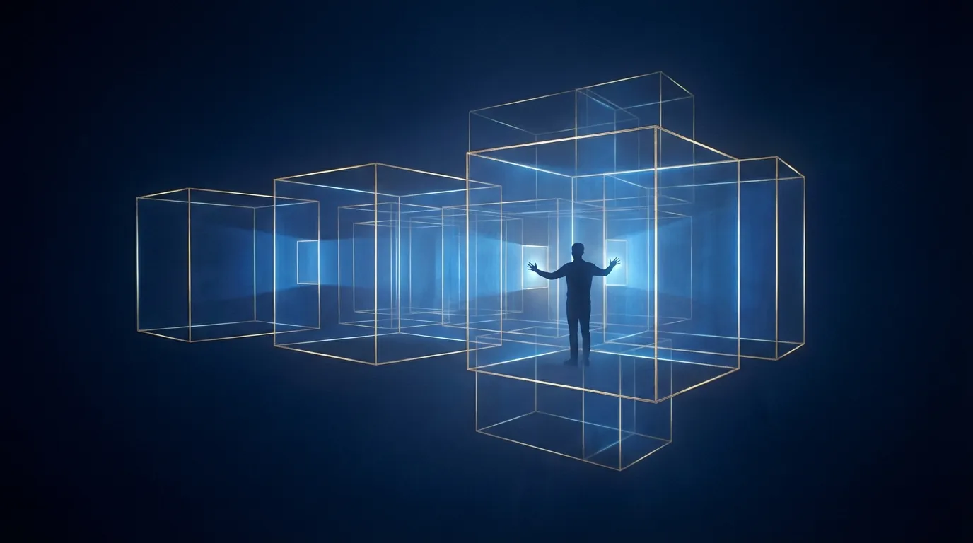
The way humans interact with computers has evolved gradually over the past four decades, from command lines to graphical interfaces, from desktops to touchscreens. However, all these interaction modes share one fundamental limitation: they are confined to two-dimensional flat surfaces. No matter how high the screen resolution or how responsive the touch input, users are always peering through a pane of glass at compressed information. When the problems enterprises face are inherently three-dimensional -- equipment maintenance, spatial planning, surgical simulation -- that pane of glass becomes the ceiling of cognitive efficiency. Milgram and Kishino proposed their reality-virtuality continuum classification framework as early as 1994[1], foreseeing the full spectrum of mixed reality, but it is only in recent years, with the simultaneous maturation of hardware and algorithms, that this framework has truly gained the conditions for large-scale commercial deployment.
In the industrial domain, the inefficiency of traditional training methods has become an operational bottleneck that can no longer be ignored. Taking equipment operation training as an example, new technicians typically require weeks or even months of one-on-one guidance from experienced personnel to reach an independent operating level. In high-risk scenarios such as medical surgery, nuclear plant emergency response, and aviation maintenance, opportunities for practice in real environments are even more scarce and costly -- every mistake can endanger lives or cause enormous financial losses. The traditional solution involves theoretical learning through text manuals and video materials, supplemented by limited hands-on practice with actual equipment, but research consistently shows that this "watch then do" approach suffers from rapidly declining knowledge retention after just two weeks.
Remote collaboration is another field deeply constrained by flat interfaces. The COVID-19 pandemic accelerated the adoption of remote work, and video conferencing tools perform adequately for text and voice communication. But when the subject of collaboration is a physical entity in three-dimensional space -- a piece of equipment requiring troubleshooting, a building under design, a production line needing layout optimization -- video screens prove insufficient. On-site technicians cannot precisely convey the spatial location of a problem to remote experts through a screen, and remote experts cannot intuitively "point out" operational steps within the physical environment. The three defining AR characteristics outlined by Azuma in his classic augmented reality survey[2] -- combining real and virtual, real-time interaction, and registration in 3D space -- directly address these core remote collaboration pain points.
In product demonstrations and sales, two-dimensional media likewise face fundamental expression bottlenecks. The texture of building materials, the proportional relationship of furniture within a specific space, the internal workings of complex machinery -- these inherently three-dimensional product characteristics inevitably lose significant information in photos and videos. Consumers struggle to form a complete understanding of products from 2D images alone, leading to persistently high return rates and protracted decision cycles. Meanwhile, the vast amount of spatial data accumulated in industrial settings -- equipment layouts, pipeline routes, building structural information -- remains locked in CAD software and flat drawings, lacking intuitive visualization methods that make it difficult for on-site decision makers to access and comprehend critical information in real time. These pain points compound each other, creating a clear market demand: enterprises need an interaction paradigm that transcends flat surfaces, naturally integrating digital information into the three-dimensional physical world.
2. Technical Solutions
2.1 AR/VR/MR Enterprise Application Development
The technological foundation of spatial computing is built upon mature 3D engine ecosystems. Unity and Unreal Engine have evolved from game development tools into core development platforms for enterprise-grade spatial applications, both offering complete XR development toolchains covering everything from scene rendering and physics simulation to user interaction. In practical implementation, engine selection depends on project characteristics: Unity offers advantages in cross-platform deployment flexibility and shorter development cycles, suitable for enterprise training and product demonstration scenarios requiring rapid iteration; Unreal Engine, with its powerful rendering pipeline and technologies like Nanite and Lumen, excels in architectural visualization and digital twin scenarios requiring high fidelity.
The maturing WebXR standard presents another noteworthy technology path for enterprises. By accessing immersive experiences directly through the browser, WebXR eliminates the friction of native app installation, dramatically lowering the entry barrier for end users. This is particularly important for customer-facing product demonstrations and cross-organizational remote collaboration -- any user with a supported device can instantly enter a spatial experience via a link, without downloading application packages of hundreds of megabytes. In our technical architecture design, we make the optimal choice between native applications and WebXR based on the scenario's performance requirements and reach, or adopt a hybrid architecture to leverage the advantages of both. Enterprise-grade XR content management systems (CMS) address the challenges of scaled deployment: unified management of 3D assets, version control, and usage analytics tracking, ensuring spatial content can be updated and maintained with the same efficiency as web content.
2.2 3D Spatial Understanding & SLAM
The core technical challenge of spatial computing lies in enabling machines to "understand" three-dimensional physical space. Simultaneous Localization and Mapping (SLAM) is the technological cornerstone of this capability. Cadena et al. systematically traced SLAM's evolution from geometric reconstruction to semantic understanding in their survey paper[4], noting that modern SLAM systems are moving from purely spatial geometric modeling toward comprehensive spatial understanding that integrates object recognition, scene semantics, and dynamic tracking.
Visual-Inertial Odometry (VIO) is the core algorithm enabling precise spatial tracking in current AR devices. It fuses visual features from cameras with motion data from inertial measurement units (IMUs) to estimate the device's pose changes across six degrees of freedom in real time. VIO accuracy and stability directly determine the "pinning" quality of virtual objects in real space -- even millisecond-level tracking offsets or centimeter-level positioning drift produce noticeable real-virtual inconsistencies in the user's perception, breaking the immersive experience. Our technical team has accumulated deep expertise in VIO algorithm optimization, including specialized techniques for maintaining tracking stability in challenging scenarios such as low light, rapid motion, and repetitive textures.
Real-time Environment Mapping extends VIO's tracking capability into comprehension of overall spatial structure. Through depth sensors or monocular depth estimation, the system progressively builds a three-dimensional mesh model of the environment as the user moves, enabling physical interaction between virtual objects and real surfaces -- a virtual ball bouncing on a real table, a virtual character being occluded by a real wall. Semantic SLAM adds object-level semantic understanding atop geometric models: the system knows not only that "there is a surface there" but can identify "that is a table" or "this is a door," enabling more intelligent real-virtual interaction logic. This semantic-level spatial understanding is profoundly significant for industrial AR assistance systems -- the system can automatically identify specific equipment components and overlay corresponding maintenance guides at the correct spatial locations.
2.3 Digital Twin Visualization
The concept of the Digital Twin has been widely discussed in the context of Industry 4.0, but its true value inflection point lies in combination with spatial computing. Traditional digital twin systems present real-time equipment status data on SCADA dashboards or 2D monitoring screens, requiring operators to mentally map abstract numerical values to actual physical equipment -- this cognitive translation process is not only time-consuming but also prone to misinterpretation.
When digital twins are projected into the spatial computing framework, the way information is presented undergoes a fundamental transformation. Technicians wearing AR headsets or using tablet AR capabilities can see real-time sensor data overlaid directly on physical equipment surfaces: motor temperature distribution displayed as a heatmap directly on the motor housing, pipeline flow rates indicated by dynamic arrows at the actual pipeline locations, and anomaly indicators positioned as prominent warning markers at the precise fault points. This experience of "seeing data on-site" frees operators from the cognitive burden of numerical interpretation, allowing their attention to focus on judgment and decision-making.
Furthermore, spatialized digital twins support simulation and prediction capabilities. Engineers can directly manipulate virtual equipment configurations in the AR environment -- moving equipment positions, changing pipeline routes, adjusting production parameters -- and observe in real time the impact of these changes on spatial layout, flow field analysis, and capacity estimates. This workflow of "experimenting in virtual, validating in reality" dramatically reduces the trial-and-error costs of factory renovations and equipment upgrades.
2.4 Apple Vision Pro & visionOS Development
The launch of Apple Vision Pro marks a pivotal shift in spatial computing from specialized devices toward a mainstream platform. The design philosophy of visionOS differs fundamentally from traditional VR/AR platforms[3]: rather than pursuing complete virtual immersion, it uses "windows in space" as its core metaphor, allowing digital content to naturally blend into the user's physical environment. This design choice profoundly influences application development thinking -- developers must rethink the spatial layout of information, the depth layers of interaction, and ergonomic comfort.
Within the visionOS technical architecture, RealityKit serves as the high-level rendering and interaction framework, providing integrated capabilities for physically-based rendering (PBR), spatial audio, gesture recognition, and eye tracking. ARKit operates at the lower level, handling spatial perception -- plane detection, scene reconstruction, light estimation, and object tracking -- providing the precise environmental understanding foundation for spatial positioning of virtual content. The deep integration of these two frameworks enables developers to build spatial applications with high-quality visual performance and natural interactive experiences with relatively streamlined development effort.
Spatial interaction design patterns represent the most challenging yet most valuable domain in visionOS development. Eye gaze as the primary pointing mechanism, finger pinch as the primary confirmation action, and natural gestures as extensions of spatial manipulation -- this interaction vocabulary is both intuitive and unfamiliar, requiring design teams to conduct extensive prototype testing and iterative optimization under human factors engineering guidance. Our design methodology emphasizes establishing interactive spatial prototypes early in development, validating interaction hypotheses through user testing, and avoiding discovery of fundamental experience problems late in the development process.
3. Application Scenarios
3.1 Industrial Training & SOP Guidance
Immersive training is the most mature spatial computing enterprise application scenario with the clearest return on investment. In VR training systems, trainees practice high-risk operations in highly realistic virtual environments -- disassembling and assembling precision equipment, executing emergency response procedures, operating heavy machinery -- where every mistake is a zero-cost learning opportunity rather than a costly accident. Research data shows that immersive training programs improve learning efficiency by approximately 60% over traditional classroom training, with significant advantages in knowledge retention: memory retention rates two weeks later increase from 20-30% with traditional methods to over 70%.
AR SOP guidance systems extend training value to the everyday work floor. When technicians perform maintenance or assembly tasks, they can see step-by-step operating instructions overlaid on the equipment through AR headsets or tablets -- marking bolts that need to be removed, indicating the correct wiring sequence, and reminding them of safety precautions. This "see while doing" guidance mode effectively reduces error rates for novice technicians while also providing experienced technicians with a standardized operating reference, ensuring every operation adheres to best practices.
3.2 Remote Repair Assistance (AR Expert Guidance)
When equipment fails, the traditional response is to dispatch a specialist technician to the site. This not only consumes travel time and cost but more critically causes production line downtime losses during the waiting period. AR remote repair assistance systems fundamentally transform this process: on-site personnel transmit real-time equipment video and spatial information to remote experts through AR devices, and the expert uses 3D Annotations on their own screen to mark operational steps directly on the real equipment view seen by the on-site personnel -- circling components that need inspection, drawing directional arrows for disassembly, and placing virtual reference documents.
This spatialized remote collaboration mode delivers quantifiable operational benefits. After deploying AR remote repair assistance systems, the First-Time Fix Rate improves by an average of 35%, meaning more failures are completely resolved during the first remote guidance session without repeated troubleshooting or scheduling on-site visits. The reduction in on-site visits directly translates to travel cost savings and improved equipment availability, and for manufacturers or equipment operators with distributed geographical footprints, annual cost savings often reach the millions.
3.3 Immersive Product Demonstrations & Configurators
Product demonstration is the spatial computing application direction with the greatest commercial potential facing consumers. AR product demonstrations allow consumers to place virtual product models in their actual spaces -- positioning a virtual sofa in a living room corner to evaluate size proportions, placing a virtual coffee machine on a kitchen counter to confirm style compatibility, or configuring an entire virtual production line in a factory space to verify layout feasibility. This "experience before purchase" decision-making model increases product demonstration conversion rates by approximately 40% over traditional 2D methods while significantly reducing return rates caused by cognitive gaps.
Interactive Product Configurators further upgrade the demonstration experience into a customization experience. Users can switch product colors, materials, and accessory combinations in real time in AR or VR environments, observe the effects of configuration changes from every angle, and even simulate the product's appearance under different lighting conditions. For high-value, highly customizable products -- automobiles, precision machinery, building materials -- this immersive configuration experience not only accelerates the sales process but also reduces specification misunderstandings and order changes caused by communication gaps.
3.4 Spatial Data Visualization
Decision makers in architecture, urban planning, and infrastructure management have long struggled to intuitively understand complex spatial data. Architectural design teams need to switch back and forth between 2D drawings and 3D models, trying to mentally reconstruct the complete picture of a space; urban planners need to assess how new buildings affect sunlight, ventilation, and visual landscapes, yet can only rely on static simulation renderings; facility managers face complex pipeline systems hidden within walls and ceilings, where every maintenance task feels like a blind exploration.
Spatial computing provides revolutionary visualization for these scenarios. AR technology can overlay BIM (Building Information Modeling) models directly onto construction sites or existing buildings, allowing design teams to "see" yet-to-be-built structures at 1:1 scale on-site, verify the alignment between design intent and actual spaces, and instantly discover conflicts between drawings and site conditions. For urban planning, mixed reality allows decision makers to "walk into" planning proposals from a pedestrian perspective, experiencing the spatial feel of completed developments within real streetscapes, thereby making planning decisions that better reflect the citizen experience.
4. Methodology and Technical Depth
4.1 From User Research to Spatial Experience Design
The success or failure of spatial computing applications often depends not on how advanced the technology is but on whether the experience design truly addresses user needs and cognitive patterns. Our methodology begins with a deep user research phase: through field observation, contextual interviews, and task analysis, we understand target users' pain points, cognitive loads, and spatial behavior patterns in their existing workflows. These insights are transformed into spatial experience design principles -- the optimal placement of information in three-dimensional space, the naturalness and learnability of interaction gestures, and the way virtual elements blend with the real environment.
Spatial Prototyping is a critical stage in our design process. Unlike traditional wireframes and 2D mockups, spatial experiences can only be truly evaluated in three-dimensional environments. We build rapid interactive spatial prototypes and invite representative users to test them, observing their natural behavior in space -- where their gaze lingers, their intuitive gesture choices, their movement paths through the space -- to iteratively optimize the design. This user-centered spatial design process ensures that the final delivered application is not only technically feasible but experientially convincing.
4.2 Performance Optimization: Balancing Frame Rate, Latency, and Visual Quality
Spatial computing applications have far higher performance requirements than traditional desktop or mobile applications. VR applications need to maintain at least 90 fps sustained frame rates to prevent motion sickness, AR applications must keep tracking latency below 20 milliseconds to ensure real-virtual consistency, and all of this must be achieved within the limited computing resources of mobile devices. Performance optimization therefore becomes the most technically demanding aspect of spatial computing development.
Our optimization strategies span every level of the rendering pipeline: LOD (Level of Detail) management and occlusion culling at the geometry level, computational complexity control at the shader level, compression format selection and streaming loading at the texture level, and multi-threaded architecture and memory management at the system level. For the special requirements of AR scenarios, we have developed adaptive quality adjustment mechanisms that dynamically adjust rendering quality based on the device's real-time computational load and battery status, finding the optimal balance between smoothness and visual performance. On high-end platforms such as Apple Vision Pro, we also perform specialized optimization for Foveated Rendering, concentrating computational resources in the area where the user's gaze is focused, achieving near-desktop-quality visuals with limited GPU resources.
4.3 Why Spatial Computing Requires Cross-Disciplinary Expertise in Computer Graphics and Human Factors Engineering
Spatial computing is a quintessentially cross-disciplinary technology: its technical foundations are rooted in computer graphics (rendering, 3D geometry, shader programming), computer vision (SLAM, object detection, depth estimation), and sensor fusion (IMU, LiDAR, cameras), yet its success or failure hinges on the quality of human factors engineering (cognitive load, spatial perception, motion comfort) and interaction design (spatial UI patterns, gesture vocabulary, information architecture).
Many spatial computing projects in the market fail precisely because teams have a capability gap between these two ends: purely technical teams can build high-performance rendering engines but design experiences that leave users dizzy or confused; purely design teams can envision elegant spatial interaction concepts but cannot realize them within the performance constraints of target hardware. Our team's ability to build differentiated capability in the spatial computing domain stems precisely from team members who possess both academic training in computer graphics and practical experience in human factors engineering -- they understand the low-level workings of GPU pipelines and also understand the perceptual characteristics and limitations of the human visual system in spatial computing contexts.
This cross-disciplinary expertise is particularly evident in the productization of SLAM algorithms. Academic SLAM systems pursue the limits of localization accuracy and map quality, but in enterprise products, SLAM systems need to maintain robustness across diverse real-world environments -- low-texture walls, dynamic occlusions, rapid user movement -- while keeping computational resource consumption at levels that do not affect the main application's frame rate. The gap between paper algorithms and production-grade engineering implementations spans not only code optimization but also deep understanding of "the acceptable floor of user experience." This is precisely where the intersection of PhD-level research capability and industry insight creates value.